IMD Update: Thunderstorms likely in coastal AP, Rayalaseema, Karnataka for a week
IMD expects a week of heavy rains, thunderstorms, and gusty winds across the South Peninsula, signaling the north-east monsoon transition.
After a lull of nearly a week, the south-west monsoon resumed its retreat on Thursday, withdrawing from the remaining parts of Maharashtra, as well as parts of Goa, Karnataka, Telangana and Odisha, and further areas of Jharkhand and Chhattisgarh.
India Meteorological Department (IMD) said the withdrawal line now runs through Supaul, Ranchi, Sundargarh, Bargarh, Bijapur, Hyderabad, Belagavi and Panjim, marking another decisive step in the four-month monsoon’s seasonal retreat and arrival in turn of the monsoon in reverse, or north-east monsoon, over the South Peninsula.
Stormy transition phase
Conditions are now becoming favourable for the monsoon to pull back from more parts of East India and the northern Peninsula, as well as many parts of the North-East, during the next three to four days. But the retreating monsoon is leaving behind an atmosphere far from quiet, particularly over the southern Peninsula.
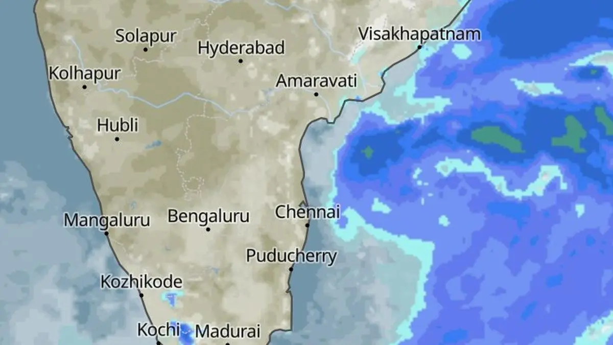
While the monsoon footprint contracts across the country, the seasonal transition is simultaneously opening the door to a more convective pattern over the South Peninsula.Rain, thunderstorms, lightning and gusty winds became entrenched on Thursday under the influence of a cyclonic circulation off the south Kerala coast and a trough extending into South Interior Karnataka.
Incoming rain wave could likely be piloted by an approaching organised weather system - low-pressure area or depression - eyeing the south Andhra Pradesh and north Tamil Nadu coasts. | Photo Credit: www.meteoblue.com
Rain, thunderstorms
Thus, even as the monsoon steadily retreats, the atmosphere remains primed for widespread pockets of rain and thunderstorms, a characteristic feature of the transitional season when the monsoon’s withdrawal from the north coincides with renewed convective activity over the South Peninsula and adjoining regions.
The pattern is expected to persist for much of the coming week. Isolated to scattered rainfall is likely over Coastal Andhra Pradesh and Yanam, Coastal Karnataka, Rayalaseema, South Interior Karnataka and Tamil Nadu, Puducherry and Karaikal for next seven days. Kerala and Mahe may see a similar unsettled spell for three days from Sunday, while Lakshadweep could remain under its influence for four days.
Widespread rain
Rainfall may be fairly widespread to widespread over Kerala and Mahe until Sunday, with another spell likely on Wednesday, while Lakshadweep could receive fairly widespread to widespread rain for three days through Sunday. The heavier spells could be locally significant. Isolated heavy rainfall is likely over Kerala and Mahe and Tamil Nadu, Puducherry and Karaikal on Friday and Saturday, and over South Interior Karnataka on Friday.
Kerala, Mahe in focus
The rain will be accompanied by an active thunderstorm regime. Isolated thunderstorms, lightning and gusty winds, with speeds of 40-50 km/hr and gusting to 60 km/hr, are likely over Tamil Nadu, Puducherry and Karaikal for five days .Kerala and Mahe and Lakshadweep could see similar conditions for three days through Saturday, with gusty winds persisting on Sunday and Monday. Coastal Andhra Pradesh and Yanam and Rayalaseema are also likely to experience thunderstorms, lightning and gusty winds for three days through Saturday.
South Interior Karnataka could see isolated thunderstorms and lightning on Friday and Saturday, while strong surface winds are likely over Coastal Andhra Pradesh and Yanam and Rayalaseema during the same period.
Weather mix up north
Farther to the north-west, a fresh western disturbance has arrived as a cyclonic circulation over north Pakistan. Ahead of it along its eastward trajectory, an upper-air cyclonic circulation lies over Haryana, drawing moist south-westerly winds inland from the Arabian Sea. The interaction is expected to generate rain and thunderstorms over parts of North-West India and East India during the next few days.
Adding another layer to the weather map is an upper-air cyclonic circulation over north-east Bihar, a remnant of an earlier western disturbance that has since moved away. An associated trough extends from this circulation to Telangana, passing across Jharkhand, Odisha and Chhattisgarh.
Source: BusinessLine Economy
Disclaimer: This article is for general information and does not constitute investment, tax or legal advice. Markets and rates change; please verify with official sources or a qualified professional before you act.